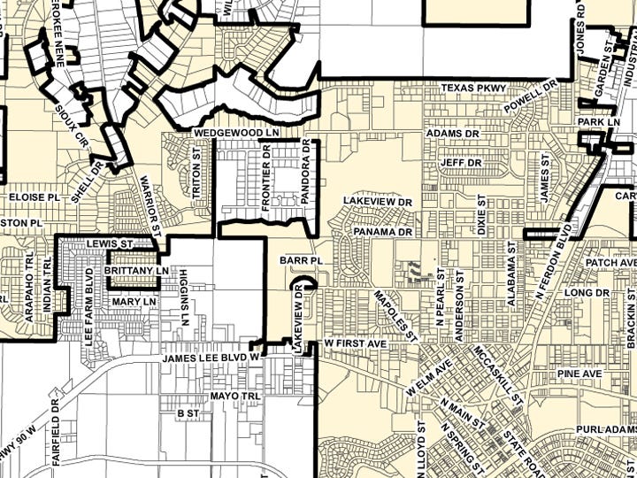

CRESTVIEW — It took nine months and countless hours’ research, but for the first time in 15 years, city officials and staff members can glance at a map and see Crestview’s boundaries.
The City Council on Monday unanimously accepted the updated map and approved having future updates incorporated into the document within 30 days of approved changes, such as annexations.
See a full size copy of the map here.
Teresa Gaillard, the Administrative Services Department's mapping analyst and city planner, spearheaded the project to produce an accurate city map.
“…She went back and researched all the ordinances and everything," City Clerk Betsy Roy said. "Now, going forward, she'll be able to update the map without going through the council. Now it can be updated whenever there's an annexation."
City attorney Jerry Miller expressed concern for the lack of an updated city map when he started his position in spring 2012. Monday, he called failure to update the old map a "ministerial deficiency."
"Knowing exactly where your city limits are and having them described in a uniform way is critical to so many jurisdictional issues," he said.
He called the previous map, which lacked updates on annexations, comprehensive plan amendments and rezoning, "an absolute heyday for any (legal) challenges."
From 2004 to 2010, the city has more than doubled in acreage, but updates to the previous map had not kept pace with the city's growth, Roy said.
Land surveyor Kermit George produced Crestview’s last comprehensive map in 1998; it was sporadically but not comprehensively updated, Roy stated in an agenda brief.
Contact News Bulletin Staff Writer Brian Hughes at 850-682-6524 or brianh@crestviewbulletin.com. Follow him on Twitter @cnbBrian.
This article originally appeared on Crestview News Bulletin: Crestview map shows city's 15-year growth (MAP)