
Drones have caught on these days. I’ve seen drone tours of properties for sale. I’ve seen a video of the Fourth of July fireworks from a drone.
Drones may be the wave of the future for farmers, too. This technology can give them an aerial view of their crops without having to leave the ground themselves.
This provides extremely useful data to the farmer. Ordinary pictures or video of the fields can be helpful to find weeds, diseases or even insect damage before they become widespread. We can even see where deer and hog damage occur in the fields.
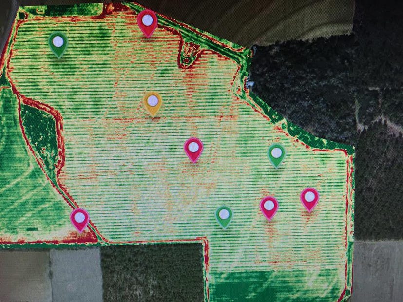
Another technology allows farmers to capture images using near infrared cameras mounted on drones and computer software to evaluate the Normalized Differential Vegetation Index (NDVI for short).
Plants with healthy chlorophyll reflect near infrared light; plants with damaged chlorophyll absorb it. NDVI picks up this difference and can quickly alert the farmer to problem areas in the field.
All this extra data helps farmers target areas of the fields that need attention. Farmers can target any pesticide or fertilizer applications to the area in need only. This decreases the amount of unnecessary chemicals on the crops and thus in the environment. It’s another precision agriculture tool that farmers can rely on.
The cost of this technology varies greatly depending on the type of drone and camera used.
A few companies make drones specifically for agricultural use, and some farmers and crop consultants are using these machines to scout their fields.
Will drones become the next big thing on farms? Only time will tell.
Jennifer Bearden is an agent at the University of Florida's Institute of Food and Agricultural Sciences Extension office in Crestview.
This article originally appeared on Crestview News Bulletin: BEARDEN: Drone technology useful for farming